Issue 4: There is no U.S. Great-Lakes-area evidence of a major earth-changing calamity
The Great Lakes area has no local active volcanos or moving tectonic plates. There is no geologic or archaeological historical evidence of area-wide time-of-Christ eruptions in that area.
Clearly, the vast A.D. 34 area-wide destruction and huge area reconfiguration is the most significant geographical event recorded in the Book of Mormon. It is connected with the death and resurrection of the Savior, Jesus Christ, being the revealed sign of the Lord’s crucifixion.
Prophecies in the Book of Mormon about Geographical Calamity
- The tempest and accompanying destruction was a major prophetic marker—an event so important that an angel revealed the future terrible destruction to Nephi 600 years before it was to take place. The event would drastically change the face of the land (1 Ne. 12:2-5). Later in his life, Nephi again foretold the great destruction that would fall on the wicked—a future event when “the depths of the earth shall swallow them up…and mountains shall cover them, and whirlwinds shall carry them away…with thunderings, and lightnings, and earthquakes and all manner of destructions (1 Ne. 26:3-6).
- Nephi also quoted prophecies of the prophets Zenock and Zenos, writing of the “vapor of darkness” and the “opening of the earth” and by “mountains which shall be carried up” that would come as a sign of Christ’s death “600 years after Lehi left Jerusalem” (1 Ne. 19:8-12).
- Centuries later, Samuel the Lamanite again foretold the terrible event in a prophecy that would be fulfilled at the time of the Savior’s death, warning that “the earth shall shake and tremble…and the earth…shall ever be found in seams and in cracks, and in broken fragments upon the face of the whole earth, yea, both above the earth and beneath…there shall be great tempests…many mountains shall be laid low, like unto a valley, and there shall be many places which are now called valleys which shall become mountains, whose height is great. And many highways shall be broken up, and many cities shall become desolate…and darkness should cover the face of the whole earth for the space of three days” (Helaman 14:20-29).
- The complete fulfillment of these prophecies is reported in detail in 2nd Nephi 8:5-25. It is continued in the next chapter (2 Nephi 9:1-15), and aftermath events are recorded in 2nd Nephi 10:1-17. A careful reading of those chapters can yield a lengthy, detailed list of the deadly tempest’s results.
In contrast, what appears to have taken place can be reconstructed by examining the past geological events and present geographic areas of Guatemala and southern Mexico. The ultra-short, simplified version of a quite-involved and much-studied subject follows:
What is subduction?
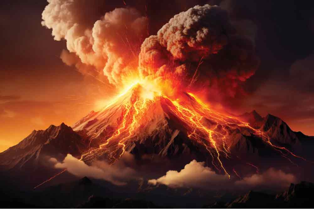
There are huge slabs (plates) of underwater earth-layers in ocean bottoms. Four of them are situated in the Guatemala/southern Mexico area; two are on the Pacific side, and the other two in the Gulf of Mexico (Atlantic) side. These plates slowly move. When they bump into each other, “subduction” occurs. This means that the edge of one plate slides over another plate, forcing it up. That upward push puts severe pressure on the earth above the upper plate that can suddenly create volcanoes and push existing land formations over adjoining areas.
If the subduction is really strong it can rearrange mountains and valleys over wide areas, making flat areas buckle up to become mountains, etc. Needing to release tremendous amounts of underground heat and pressure, volcanos can spurt out fire and volcanic ashes that spread across the countryside. Rising hot air from the volcanos can also form fierce whirlwinds that can cause additional damage.
Guatemala and the Isthmus of Tehuantepec have been geographically altered by calamities
It’s obvious that Guatemala and the Isthmus of Tehuantepec have been drastically shaped and reshaped over the centuries. Are there active volcanos in the area believed to be the Book of Mormon area? A quick search of Google yields: “Guatemala is crossed by a large chain of volcanoes. Between Mexico in the north and the neighbors to the south (Honduras & Salvador), there are no less than 300 volcanic structures, of which 37 are recognized as volcanoes.” Also: “Out of 11 volcanos in Guatemala, 8 are considered still active. Guatemala is located on the Pacific Ring of Fire, which stretches for about 40,000 km around the Pacific Ocean. Here the tectonic plate of the Pacific collides with several surrounding continental plates, and seismic tremors occur again and again.” Also, a volcano “sits about 16 kilometers (9.9 mi) west of Antigua, one of Guatemala’s most famous cities and a tourist destination. It has erupted frequently since the Spanish conquest, most recently in June and November 2018, 23 September 2021, and 11 December 2022.”
Summary of Geographic Calamity:
- Guatemala and southern Mexico’s landscapes show numerous signs of having been reshaped by tectonic subduction instances over the centuries. Rugged mountain ranges and valleys stretch across both of the countries.
- These areas have numerous volcanos, several of them still active.
- Coupled with numerous other geographical evidence, these areas clearly appear to be areas where the Book of Mormon’s great tempest occurred.
- The New York area has no active volcanoes. It also has no history of major tectonic-level earthquakes or storms that would meet the descriptions provided in the Book of Mormon.